
3D Laser Scanning Geelong
Accurate as-built drawings and point clouds, captured by experienced engineering surveyors.
Storm Spatial scans buildings, plant rooms, factories and construction sites across Geelong and Victoria. With mine site, civil, bridge and major project experience behind us, we know what your project needs from the data, and we deliver it in a format your team can use.
Years Surveying Experience
Projects Delivered

MGA2020 & AHD Datum Control
Google Rating
What Is 3D Laser Scanning?
A laser scanner measures the visible surfaces around it from several positions. We align those scans into one accurate 3D record of your site, then turn it into the drawings or data your team needs.
Point Cloud Capture
3D Models on Request
As-Built Drawings
Design vs Scan
Scanned by Experienced Engineering Surveyors
A scanner is only as good as the surveyor running it. Our team has spent 20+ years on mine sites, civil projects, bridges and major infrastructure, and we bring that same discipline to every scan.
Mine Sites & Resources
Our team’s experience includes Roy Hill, BHP, Karara Iron Ore and the Fortescue Metals Group rail loop. We’re used to remote sites, working plant and strict site controls.
Civil & Major Infrastructure
Project experience includes North East Link and the Waurn Ponds rail duplication. We understand staging, tight programmes and documentation that stands up to review.
Bridges & Structures
From bridge construction surveys to movement monitoring and structural setout, we know how tolerances affect what gets built on site.
Industrial Plant & Mechanical Setout
Our work includes the Tasgas compression station and mechanical setout for the AAMI Park big screen replacement. We bring that same care to plant rooms and tie-ins.
That means proper survey control, sensible checks and data tied to your project coordinates. Not just a pretty point cloud.
What You Get from a Scan
One scan can support several outputs. Tell us what you need to design, measure or check, and we’ll scope the right deliverable before we start.

2D As-Built Plans & Elevations
- Floor plans, sections and elevations drawn from the scan
- Real dimensions: what was built, not what was designed
- Delivered in DWG, DXF or PDF

Registered Point Cloud
- A complete measured 3D record of the scanned area
- Delivered in E57, RCP or LAS
- Tied to MGA2020 and AHD, or your project coordinates, on request

Sections & Roof Surveys
- Building sections, clear heights and facades
- Drone capture for roofs and hard-to-reach areas
- Can be combined with a feature and level survey

Design vs Scan Checks
- Compare your design against what’s actually on site
- Find clashes and deviations before fabrication or setout
- Reported against the tolerances agreed for your job
Construction-Stage Records
- Capture structure and services at agreed milestones
- Record what’s in place before walls and ceilings close
- Keep a measured record for your project team

3D & BIM Models on Request
- Need an editable model? Tell us how you’ll use it
- Elements, detail and formats are agreed up front
- Scoped as a separate item for each job
Where 3D Scanning Helps
Existing drawings don’t always match what’s on site. A measured scan gives your team a reliable starting point.
Renovations & Fit-Outs
Get accurate existing conditions before design or demolition starts.
Plant Rooms & Mechanical Tie-Ins
Confirm space, routes and connection points before anything is fabricated.
Structural Steel & Construction Checks
Check what’s been built against the design before the next trade moves in.
Before Services Are Covered
Record exposed services and structure before they disappear behind finishes.
Factories & Industrial Sites
Capture complex, congested areas with minimal disruption to operations.
Heritage Buildings
Record buildings and details without touching them.
How It Works
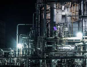
Step 1 — Tell Us What You Need.
Send us the location, what you’re trying to design, measure or check, and any plans or photos you have.
We’ll confirm the scope and give you a clear quote before any work starts.
We’ll confirm the scope and give you a clear quote before any work starts.
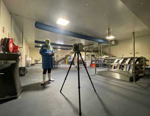
Step 2 — We Scan the Site.
Our engineering surveyors scan from multiple positions to capture the required areas. We set up survey control when the job needs it and plan around your access, site rules and operations.
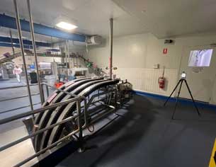
Step 3 — We Check and Deliver.
We align the scans, check the data and prepare your agreed drawings or files. You’ll also get clear notes on coverage and any limitations.
Who We Scan For
- Builders and construction managers
- Architects and designers
- Structural and mechanical engineers
- Mechanical and hydraulic contractors
- Factory, plant and facility managers
- Heritage consultants
Recent scanning work includes mechanical plant at a water treatment facility and a working dairy factory in south-west Victoria.
Why Storm Spatial
Surveyors, Not Just Scanners
- We understand control, tolerances and where errors creep in
- Data can be tied to MGA2020, AHD or your site grid
- Checked by people who know how the data will be used
Clear Scope. No Surprises.
- What’s included is agreed in writing before we mobilise
- We’ll tell you what the scan can and can’t capture
- What we quote is what you get
Data You Can Actually Use
- We don’t hand you a point cloud and walk away
- Files are delivered in the formats your team needs
- Clear notes on coverage and limitations
Local to Geelong
- Based in Geelong, working across Victoria
- Surf Coast, Bellarine, Melbourne and regional Victoria
- Call us and speak with the person running your job
What a Scan Can and Can’t See: A laser scanner records visible surfaces. It can’t see through walls, finishes or enclosures, and objects can hide what’s behind them. We plan scan positions to reduce gaps and note any areas we couldn’t capture.
Frequently Asked Questions
What do I receive from a 3D scan?
It depends on your project. Most clients need a registered point cloud, as-built drawings, or both. We confirm the deliverables, detail and file formats before work starts.
How much does 3D laser scanning cost?
Cost depends on the site size, access, complexity, required accuracy and the amount of drafting or modelling. Send us the address, approximate area, any plans or photos and your timeframe, and we’ll provide a project-specific quote.
How accurate is a 3D scan?
Accuracy depends on the equipment, site conditions, control and processing, so one figure doesn’t suit every job. We agree the requirements for your project and the checks needed to support them.
Is a point cloud the same as a BIM model?
No. A point cloud is a set of measured points. A BIM model contains building elements such as walls, floors and services. Many projects only need the point cloud or drawings. If you need an editable model, we scope it separately.
Can you scan occupied buildings and working plant?
Often, yes, with the right planning. Access, moving people and equipment and site rules can affect coverage and timing, so we confirm these before attending. Our team is used to working on active sites.
Can the scanner see through walls?
No. Laser scanning records visible surfaces only. Exposed services can be scanned before they’re covered if we plan a visit at the right stage of construction.
Can my designer use the data?
Yes, as long as we agree the format first. Tell us which software your designer uses and whether they need a point cloud, drawings or a model.
Can the scan connect to our project coordinates?
Yes. We’re surveyors, so we can tie scan data to MGA2020 and AHD, or to your site grid, when the job requires it. Let us know at the enquiry stage.
Ready to Scan Your Site?
Tell us a little about your project and we’ll get back to you fast. Helpful details include:
- Your site address
- What you need to design, measure or check
- Approximate area
- Any plans or photos
- Your timeframe