
As agricultural practices evolve, the need for precise, actionable data becomes paramount. For large cereal crop farmers, understanding the health of thousands of hectares can feel like an impossible task. At Storm Spatial, we’ve come to appreciate the critical importance of NDVI mapping and its ability to revolutionise crop management. NDVI mapping refers to the process of creating detailed maps that illustrate crop health and highlight problem areas, such as weed infestations or nutrient deficiencies. These insights are essential for maximising yields and ensuring the long-term productivity of our farms. In this article, we’ll explore the significance of NDVI mapping, our innovative methods, and the immense advantages it offers.
The Importance of Mapping Crop Health
Healthy crops are the foundation of a successful harvest. They provide us with the food we need, and their robust growth directly impacts a farmer’s livelihood. Despite their vital importance, issues like early-stage disease or emerging weed pressure can often go unnoticed across vast fields until they’ve already caused significant damage. We’ve seen it too many times where farmers are reacting to visible problems, rather than proactively addressing them. This lack of early information can result in significant yield losses and increased input costs as more drastic measures become necessary. Furthermore, undetected issues can spread rapidly, leading to broader crop damage and reduced overall farm profitability.
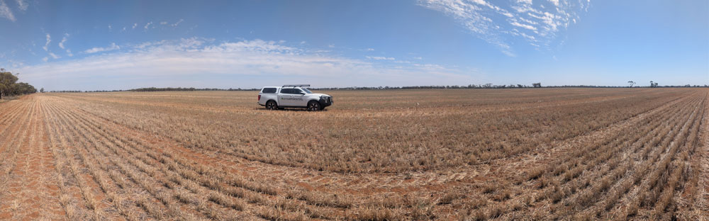
Here in Victoria, we face unique challenges. The lack of desperately needed rain, followed by sudden cold snaps, creates particularly tough conditions for our crops. These uneven growth patterns are becoming more prevalent, making it incredibly difficult for farmers to identify and address struggling areas manually. Mapping crop health with NDVI is essential for ensuring robust yields and sustainable farming practices, especially when faced with these erratic weather patterns. By accurately mapping the vigour of your crops, we can identify potential hazards early and take steps to mitigate them. We can also plan interventions more efficiently, reducing the risk of widespread crop damage and maximising your return on investment.
Risks of Not Mapping Crop Health Early
The risks of not accurately mapping crop health can be severe. Undetected disease can spread quickly, leading to widespread plant stress and significantly reduced yields. Unnoticed weed infestations can outcompete crops for vital nutrients and water, impacting growth and ultimately harvest quality. These issues can result in costly losses in revenue, increased spending on reactive treatments, and even long-term soil health problems if not addressed promptly. Accurately mapping crop health can help prevent these losses by providing precise information about the location and severity of plant stress, weed outbreaks, or other issues.
When cold snaps hit or rain remains stubbornly absent, the stress on crops is immediate and often invisible from the ground. If these uneven patterns of growth aren’t monitored, farmers are left guessing, and potential yield is left on the table. Monitoring these patterns is key to bringing yields up to where we’d much rather see them.
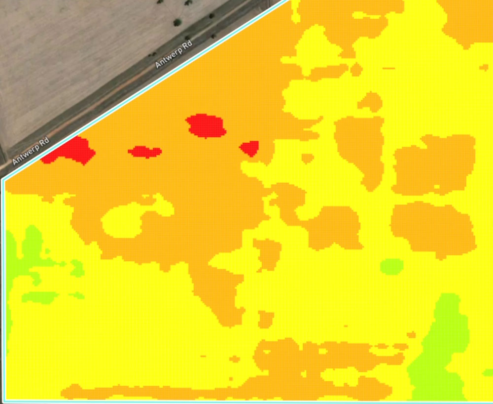
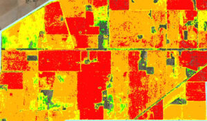
Our Methods for Large-Scale NDVI Mapping
Various methods can be used for NDVI mapping, but for thousands of hectares, we employ a sophisticated, multi-faceted approach:
Broad-Acre NDVI Coverage:
Our primary method involves comprehensive large-scale data acquisition that covers your entire farm, overcoming the limitations of daily drone flights over vast areas. This ensures no section of your property is left unanalysed.
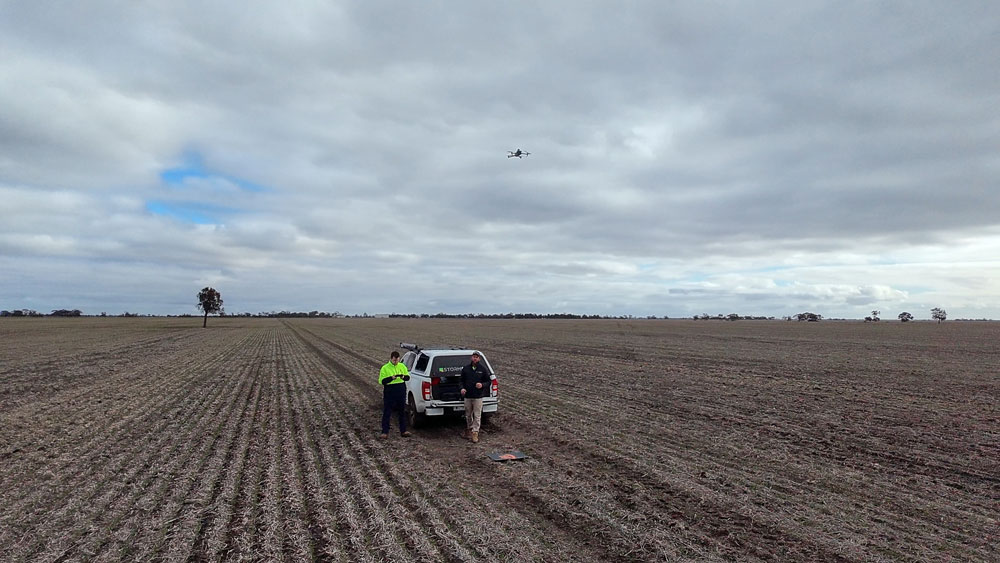
Drone Survey Ground Truthing:
While our broad-acre data provides the essential overview, we use drone surveys as precise quality checks. These drone flights provide high-resolution imagery and data for specific areas, allowing us to “ground truth” the larger datasets and ensure the accuracy and reliability of our maps.
Crucially, our ground-truthing goes beyond just drone data. We believe in truly understanding your land. Our team at Storm Spatial actively engages with the landowner or farmer, walking and driving the crop to identify known areas of concern. We’ll check for soil moisture levels and soil health, gaining invaluable first-hand knowledge of what reflection we may see. Whilst doing that, we simultaneously set up our ground control for our surveys. This meticulous process enables us to create highly accurate terrain modelling and thoroughly analyse water flow, or the lack thereof, across your paddocks. This gives our farmers a crucial bird’s-eye and 3D view of what may be happening per paddock, and how it might affect adjacent areas.
Multi-Tiered Zonation:
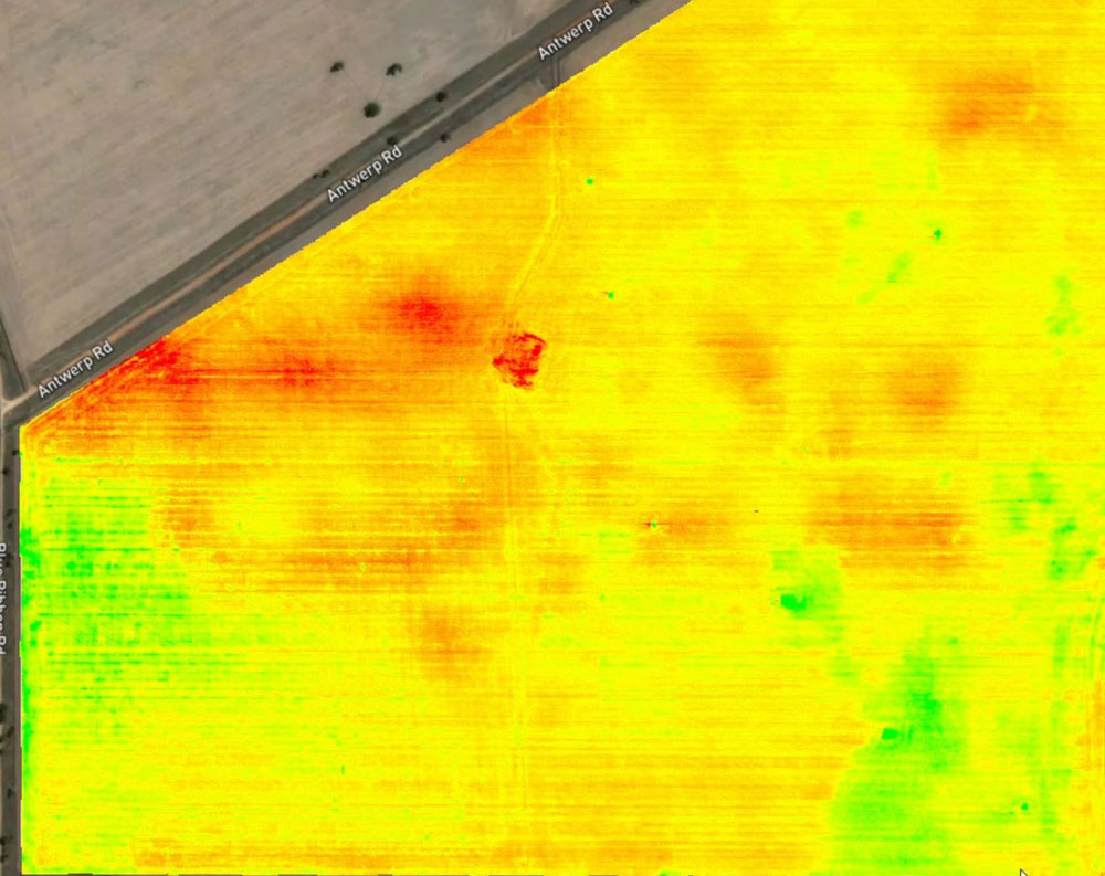
A key element of our service is the ability to zone off your NDVI maps into 3, 4, or 5 tiers. This powerful feature enables farmers to prioritise interventions. For example, you can focus your resources on the worst 20% affected areas first, or apply variable rate treatments to the worst 60%, optimising input usage and maximising efficiency.
Advantages of Storm Spatial’s NDVI Mapping
Three main reasons why accurate and large-scale NDVI mapping from Storm Spatial is advantageous for project stakeholders:
Efficient Crop Management:
Accurate NDVI mapping provides design teams (and farmers!) with vital information about crop vigour, stress levels, and weed locations. This knowledge enables them to plan interventions more efficiently, targeting specific areas that need attention and optimising resource allocation. Efficient crop management minimises the risk of costly delays in treatment and ensures timely action.
Cost Savings:
Precise mapping helps design teams identify potential crop issues early in the growth cycle. By avoiding widespread damage due to undetected disease or weeds, costly reactive treatments and associated yield losses can be mitigated. Design teams can optimise fertiliser application, herbicide use, and other inputs through variable rate application, leading to significant cost savings.
Enhanced Yield and Risk Mitigation:
Knowing the exact health status of your crops enhances overall farm productivity. Design teams can implement proactive measures to prevent widespread issues, protecting your harvest and your investment. By reducing the likelihood of severe crop loss, they also minimise the risk of financial liabilities and associated expenses.
Challenges of Large-Scale Crop Health Mapping
Mapping large-scale crop health can be a challenging task. Some of the challenges include:
Data Volume and Processing:
Processing NDVI data for thousands of hectares generates immense data volumes. Without specialised systems, analysing and interpreting this data can be overwhelming and time-consuming.
Timeliness of Action:
Even with accurate maps, the window for intervention in agriculture can be narrow. Rapid reaction is crucial before issues escalate.
Integration with Existing Farm Equipment:
For many farmers, integrating new data insights with their existing machinery (like John Deere or Isobus systems) can be a hurdle.
Our Solution and Reaction Capabilities
Technological advancements have made large-scale NDVI mapping more accurate and efficient. The development of advanced sensors and data processing algorithms has made it possible to map crop health quickly and accurately. The use of our multi-faceted data acquisition approach, combined with drone quality checks, allows for incredibly efficient mapping of vast agricultural areas.
At Storm Spatial, we’ve developed a comprehensive solution that not only provides superior mapping but also enables immediate action. We have the ability to react with our farms from when weeds or disease is spotted, to spraying large, thousands of hectares as soon as practically possible. We can create zonation operations for John Deere and Isobus systems, ensuring seamless integration with your current equipment. Additionally, we can deploy our Spray Drone if required to put out spot fires – providing targeted and rapid treatment for specific problem areas.
Best Practices for Maximising NDVI Benefits
The best practice for accurately leveraging NDVI mapping involves a collaborative effort between our data specialists and your farm management. This ensures that the mapped data aligns with your operational goals and meets your specific needs. By adhering to a data-driven approach, farmers can confidently make informed decisions based on precise and validated crop health information, minimising risks and optimising project outcomes.
Conclusion and Future of Precision Agriculture
In the future, mapping crop health is likely to become even more automated and digitised, leveraging technologies like Artificial Intelligence (AI), Machine Learning (ML), and the Internet of Things (IoT). Advanced sensors and autonomous drones may play a significant role in conducting continuous surveys and gathering real-time data, enhancing the accuracy and efficiency of crop health monitoring. Moreover, cloud-based GIS platforms will enable seamless collaboration and data sharing among stakeholders, leading to better-informed decision-making. Overall, the future of precision agriculture is expected to be more interconnected, intelligent, and streamlined, empowering farmers with enhanced crop management and development.
Takeaway
At Storm Spatial, we’ve seen firsthand the transformative power of proactive NDVI mapping for large-scale cereal farms. We are committed to contributing to the field and leveraging emerging technologies to ensure improved productivity, reducing costs, and mitigating potential risks to achieve optimal outcomes. Our solutions are designed to keep you ahead of the curve, ensuring your crops are healthy and your yields are maximised.
Ready to unlock the full potential of your farm?
Contact Storm Spatial today to learn how our NDVI mapping can revolutionise your crop management!
Braydon Storm – Director
Storm Spatial