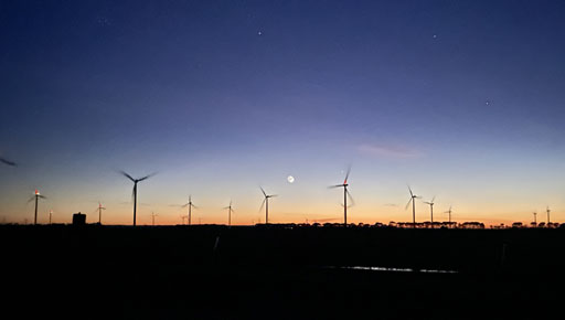
Wind energy is a cornerstone of the renewable energy revolution, and wind farms play a pivotal role in harnessing this abundant natural resource in our region in Victoria. Drone Mapping and Engineering Surveying are crucial aspects of wind farm development, facilitating efficient planning, construction, and operation. From site selection to ongoing monitoring, surveying practices are essential for optimising performance, minimising environmental impact, and ensuring the long-term viability of wind energy projects.
1.Site Selection and Feasibility Studies
Before the construction of a wind farm can begin, extensive site selection and feasibility studies are conducted. Surveyors play a key role in this initial phase by assessing various factors such as wind resource availability, terrain characteristics, environmental considerations, and proximity to existing infrastructure.
Utilising advanced remote sensing technologies like LiDAR (Light Detection and Ranging) and GIS (Geographic Information Systems), surveyors can accurately map wind patterns, analyse topography, and identify potential obstacles such as trees, buildings, or geographical features that may affect wind flow. Survey data is crucial for determining the optimal layout of turbines and infrastructure to maximize energy production while minimising costs and environmental impact.
2.Pre-Construction Surveys
Once a suitable site has been identified, pre-construction surveys are conducted to gather detailed information for the design and planning stages. Surveyors employ a variety of techniques, including ground surveys, aerial surveys, and geotechnical investigations, to collect data on soil conditions, vegetation, wildlife habitats, cultural heritage sites, and other environmental factors.
These surveys help developers mitigate potential risks and comply with regulatory requirements by identifying sensitive areas that may require protection or mitigation measures. By integrating environmental considerations into the design process, wind farm developers can minimise their ecological footprint and enhance the project’s overall sustainability.
3.Construction and Installation
During the construction phase, surveyors play a critical role in ensuring the accurate placement of turbines, access roads, and other infrastructure components. Using GPS (Global Positioning System) technology and total stations, survey teams precisely mark the locations of turbine foundations, anchor points, and electrical infrastructure according to engineering specifications.

4.Real Time Design Changes
Wind farm projects often face real-time design challenges, particularly with access roads, due to unexpected issues like post-storm runoff and rock formations during turbine excavations. Surveyors and engineers must quickly adapt to these challenges, adjusting road gradients or drainage systems to maintain safe access and prevent erosion. Similarly, encountering rock may necessitate modifications to foundation designs or equipment to ensure structural stability. These challenges underscore the dynamic nature of wind farm development and the importance of flexible problem-solving in surveying.

5.Design Compliance and Conformance
Surveyors oversee construction to ensure adherence to design plans, environmental permits, and safety regulations, including conformance with access road and turbine hold-down bolt specifications. Through meticulous record-keeping and frequent site inspections, survey teams mitigate errors, minimise rework, and facilitate smooth and efficient construction processes.
6.Survey Automation
Drones
RTK-enabled drones, coupled with a surveyor’s expertise in ground control and tying into site coordinates, offer a powerful toolset for various tasks on wind farm sites. With precise positioning capabilities, these drones can efficiently conduct pickups and conformance surveys along extensive sections of access tracks, providing accurate data on road conditions and compliance with design specifications. Moreover, their capability for detailed aerial imaging facilitates excavation and volume reports, enabling precise monitoring of earthworks progress and ensuring adherence to project timelines. Additionally, surveyors can leverage drones for safety inspections, swiftly identifying potential hazards or compliance issues across the site. Periodic aerial imaging further enhances project oversight, allowing for proactive decision-making and ensuring the efficient and safe execution of wind farm construction and operation.
Machine Control
GPS machine control technology revolutionises the construction of access tracks and turbine foundation excavations on wind farm sites by streamlining processes and eliminating the need for traditional survey staking. Equipped with meticulously computed surface models, excavators, graders, and dozers can operate with pinpoint accuracy, ensuring precise grading and earthmoving activities. By integrating GPS guidance systems into this heavy machinery, operators can effectively navigate terrain variations and adhere to design specifications in real-time. This not only accelerates the construction timeline but also reduces the reliance on manual surveying methods, thereby minimising costs associated with stakeouts and survey labour. The result is a more efficient and cost-effective approach to building access tracks, enhancing overall project productivity and enabling smoother operations throughout wind farm development.
Powerful Survey Software
A surveyor proficient in a range of software tools like 12D, TBC, and Pix4D can leverage their combined capabilities to streamline wind farm development processes. By integrating these tools, they can efficiently compute machine control data files, generate conformance reports, and detect errors onsite. With a well-organized data management system, the surveyor ensures seamless coordination between software platforms, facilitating effective communication with clients, stakeholders, and the community. This integrated approach enhances project efficiency, accuracy, and transparency, contributing to successful wind farm development.
Conclusion
In conclusion, multidisciplinary surveyors play a crucial role in the development of wind farm projects, providing essential expertise and adaptability throughout the process. Their effective communication and problem-solving abilities are key to overcoming challenges encountered from site selection to maintenance. By leveraging cutting-edge technologies and collaborating across disciplines, surveyors contribute to the successful implementation of wind energy projects.
Braydon Storm
Director, Storm Spatial

